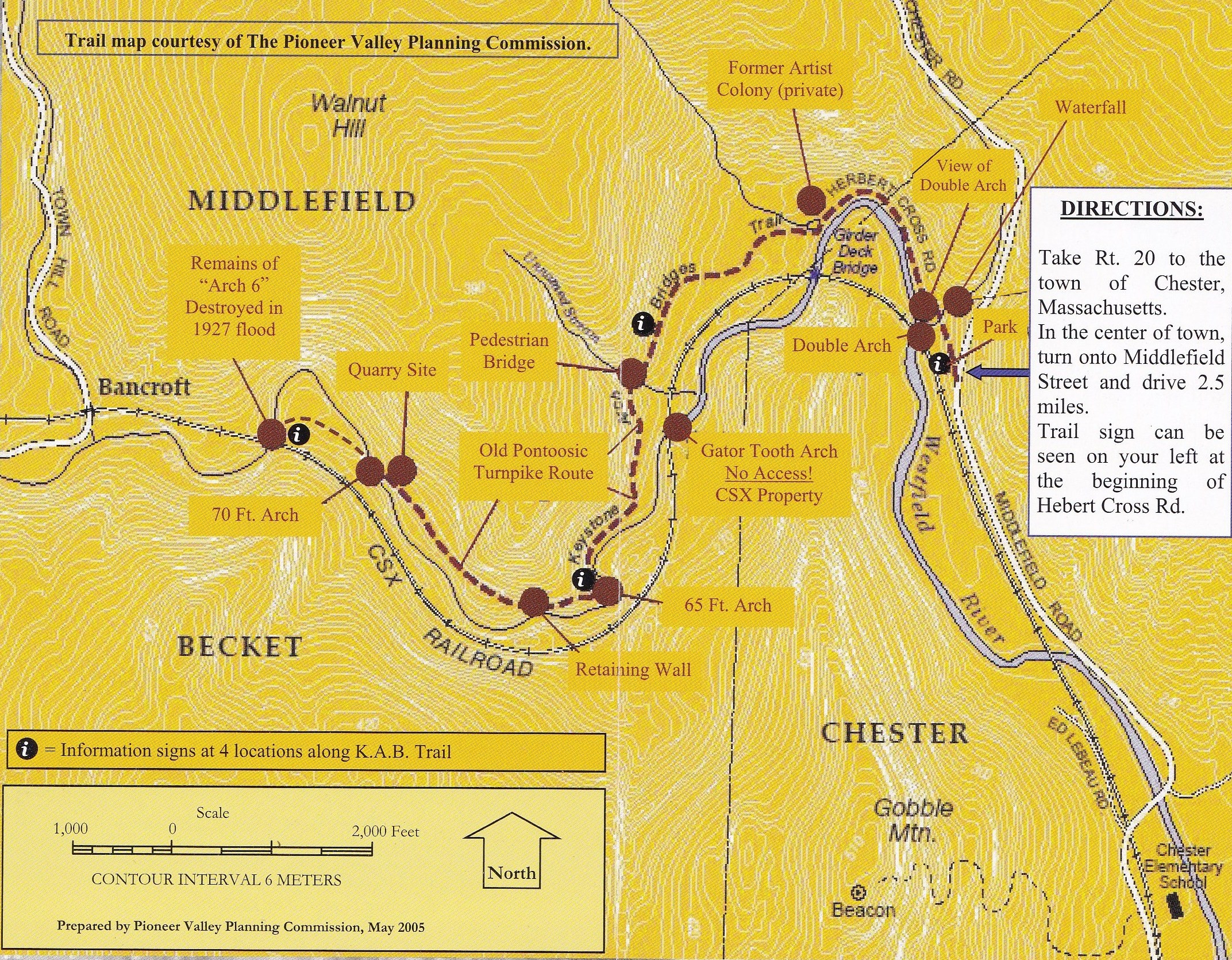
Click Image to Enlarge
Click Here for a
Printable Map
Outdoor Activities & Sports
Hiking:
The Keystone Arch Bridges Trail offers a moderate walk for all
ages. Caution must be offered that there are some extreme drop-offs, and
children and pets must be attended at all times. The trail proper measures
2.5 miles for a total round trip of five miles. This is somewhat misleading,
in that there are a number of ancillary trails down to the river at each
bridge which can, if followed, add considerable time and distance to your
day.
Participants can get as much or as little of a workout as they
desire. In general, it is recommended to allow at least five hours to
complete the trip and absorb all the wonders present. Friends of the
Keystone Arches offer guided hikes for groups of 10 to 25 individuals. A
donation of five dollars each is requested and will be used for trail
maintenance.
There is much history and hidden details the uninitiated could
miss if unescorted.
Mountain Biking (cycling):
The K.A.B. Trail is also great for a day of serious mountain /
off-road cycling for moderate to expert riders. Parts of the trail and
ancillary trails stay wet throughout the summer months for added challenges
with mud & water �not recommended for novice riders.
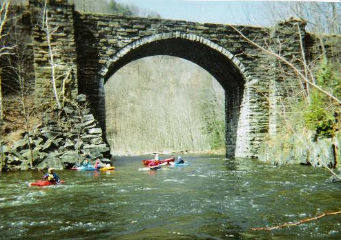
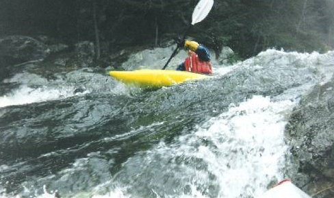
Kayaking:
Primarily a spring sport, in 2003, enthusiasts were still
paddling in August due to sustained heavy rains. Recommended for experts
only, it contains class IV rapids, 50 foot and up to 100 feet per mile
drops. It is the only uncontrolled branch of the Westfield River and as such
may rise or fall suddenly. The remoteness of the area also makes assistance
in the event of a mishap unlikely.
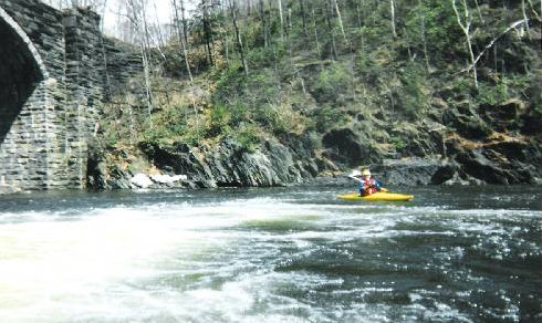
To reach the launching point in Bancroft, go north on Route 20
about 2.2 miles past Chester center to Wade Inn Rd., which angles off to the
right up a steep hill. Follow Wade Inn Rd. about 3 miles to Bancroft Rd. on
the right. Follow this until you arrive at the unmistakable keystone arch
bridge which looms over both the road and the river.
If the rocks in the river are covered at Bancroft, expect a
roller-coaster ride below. However, if they are somewhat bare, a fair amount
of maneuvering will be called for in several spots. Most rapids are followed
by pools. In several places the channel is quite narrow, so fallen trees
could be a real hazard, especially at higher levels. A railroad follows the
river, but there are no roads close by until the Middlefield Road approaches
near the end, so the trip is somewhat isolated. The first 3.0 miles of the
trip are definitely the most exciting; thereafter the rapids are more
straightforward, although there is still a strong current. This trip is
rated class III-IV depending on water level.
Hunting & Fishing:
The land on which
sit the two tallest, now discontinued arches belongs to the Massachusetts
Commonwealth Division of Fisheries & Wildlife. It is stocked each spring.
The upper reaches and some of the tributaries are home to brown trout and
small natives. Hikers are advised to be aware of the various hunting seasons
and avoid shotgun deer season, from the first Monday after Thanksgiving for
the following two weeks.
Hunting & Fishing Seasons and Limit
The Keystone Arches are in Zone 2
Note: In Massachusetts, hunting is not permitted on Sundays.
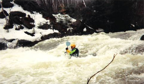
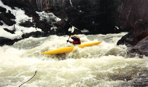
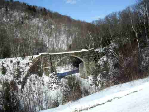
Winter on the
Trail:
Don't let old man winter keep you away
from the Keystone Arch Bridges Trail. Conditions are especially
beautiful in winter, as evidenced by this shot of the 65 ft. Arch on a
frigid January day. Cold air, low in moisture content, allows for
exceptionally clear photos, film or digital.
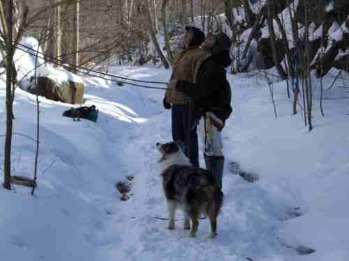
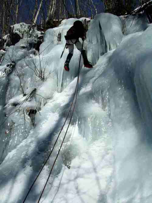
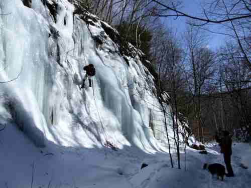
More vigorous exercise is available along the magnificent ice flows emerging
from the aquifer that was severed by building the original alignment. Here
are three shots from a recent climb. Do not attempt this without proper
gear and training. There are a number of safety rules and
proper use and care of equipment that can keep your adventure from becoming
a tragedy.
|